Weather systems bring cooler conditions and increased rainfall to central and eastern South Africa over the weekend.
Image: Doctor Ngcobo/Independent Newspapers
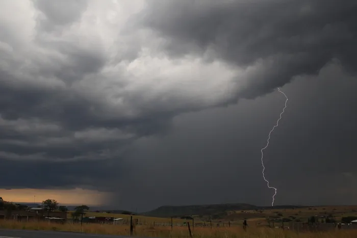
A shift in the weather pattern is expected to bring cooler conditions and increased rainfall across much of central and eastern South Africa this weekend, according to the South African Weather Service forecasts for Saturday, 27 and Sunday, September 28, 2025.
Saturday will see a significant build-up of cloud and precipitation over the central interior, with widespread showers and thundershowers expected in parts of the Northern Cape, southern Free State, and the northern Eastern Cape.
The rain probability in these regions is pegged at 60%, while isolated storms with a 30% chance are likely in the surrounding areas, including the North West, Gauteng, and parts of the Western and Eastern Cape.
Conditions across the central plateau will generally be cool, particularly in areas under cloud cover. Winds are forecast to be moderate to fresh in most regions, with stronger gusts near the coasts and over elevated terrain.
Sunday marks a notable eastward shift of the rain-bearing system. Scattered showers and thundershower with a 60% chance are forecast for KwaZulu-Natal, the eastern parts of the Eastern Cape, and the southern Highveld, including eastern Free State and Mpumalanga.
Isolated showers with a 30% chance could persist over parts of the central interior and along the southern coast between George and Port Elizabeth.
Temperatures will remain cooler over the east due to cloud cover and rainfall, while warmer, drier conditions are expected to return to the western parts of the country, particularly in the Northern Cape and Western Cape interior.
A cold front brushing the southern coastline will also contribute to rainy conditions in coastal towns from Cape Agulhas through to Gqeberha, with a 60% chance of rain along the Garden Route on Sunday.
Coastal winds will pick up in response to the frontal system, bringing gusty conditions particularly along the south and southeast coastlines.
As the country transitions into spring, this weekend serves as a reminder that sharp weather changes remain possible.
IOL News